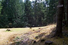
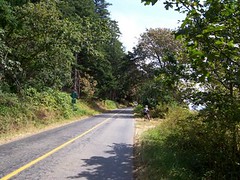
Thursday, September 29, 2005

bench3-view


bench3-view
Originally uploaded by Boonerator.
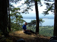
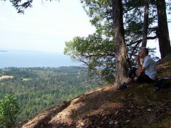
This is the spot that gets photographed a lot for Hornby tourist brochures.
The view really is spectacular.

bench trail 2


bench2
Originally uploaded by Boonerator.
A little farther on the Bench trail on the way to the Ferry..

bench trail 1


bench1
Originally uploaded by Boonerator.
Bench trail after the climb up from Strachan Road

wayne-climbing


wayne-climbing
Originally uploaded by Boonerator.
On the way up Strachan Road, you can turn left up a small road, (not exactly as illustrated) then work your way up a truly brutal hill. Wayne climbed it, I walked it pushing a 30 lb hardtail.
It leads to the Bench trail back to the ferry terminal.

no-horses-wayne


no-horses-wayne
Originally uploaded by Boonerator.
At the bottom of Toad's Ride with a detour or two, you go down to the bottom of No-Horses. A very bermed stream bed that is harder and safer than it looks.

toad3


toad3
Originally uploaded by Boonerator.
Mid-way down Toad's ride, a log provided by the managment lets Wayne practice some obstacle climbing.

toad 2?


toad2
Originally uploaded by Boonerator.
This may be down Toad's ride, but it could be almost anywhere on Hornby

sweet Singletrack2


sweet2
Originally uploaded by Boonerator.
Singletrack in the trees. It's a little wider than true singletack but it has the curves to make it "swoopy".

sweet singletrack1


sweet1
Originally uploaded by Boonerator.
Smooth,fast singletrack

toads-ride


toads-ride
Originally uploaded by Boonerator.
Go back down from the summit and you see the start of Toad's ride.

This one is a lot of fun. The next few photos are from various points on the trail. It eventually winds up on the famous No Horses trail.

rb-at-top


rb-at-top
Originally uploaded by Boonerator.
Me, taking some lunch at the summit.

wayne-at-top


wayne-at-top
Originally uploaded by Boonerator.
Wayne at summit of Mount Jeffrey

hot-rims-sign


hot-rims-sign
Originally uploaded by Boonerator.
All the way up Northwind, turn left onto Cold Deck and you get to the summit.
The signs tell you which trails are
legit for bikes.

north-way-intersection


north-way-intersection
Originally uploaded by Boonerator.
Northwind and The Way intersection. Good signs off Northwind. Several trails intersect Northwind, most have signs like this.
You can climb then, none of the grades are too steep.

northwind-climb


northwind-climb
Originally uploaded by Boonerator.
Northwind is mostly gentle climbing, but long. The first part to the Washing Machine intersection is the steepest.

northwind-entrance-gate


northwind-entrance-gate
Originally uploaded by Boonerator.
If you get to this gate, you are at the bottom of Northwind, the main trail up to the top.
It took a few tries to get here, my map reading skills could use some work.

strachan-to-northwind


strachan-to-northwind
Originally uploaded by Boonerator.
After riding on the road for a few K, don't miss the left turn onto Strachan Road. Up the road a K or two and you are almost there.
To the right is an entrance to Northwind, turn at the Child crossing sign.

road-climb


road-climb
Originally uploaded by Boonerator.
At the end of Spit trail, you climb on Central road for a few K to get to the bottom of Strachan Road.

Hornby Island start


start
Originally uploaded by Boonerator.
I spent 3 days biking on Hornby Island this August.
These pictures are more or less in order of the method you can use to get to the trials.
You still need to buy a map at the bike shop at the Co-Op.
Consider these illustrations of the map.
Richard