Monday, June 20, 2005

Let's try this as a slideshow and see if it works. Click on the link below for the photos.
Slide show of the race.


Richard and Rej.

Cumberland 12 hour race

On June 18, Cumberland had a 12 hour race which I would have enjoyed except for a variety of boring reasons.
Instead of a long post about this, (considering I was not there), I'll make a link to the Flickr photo set about the race, using pictures provided by Rej.
See the next post, blogged from Flickr.
Click on the picture and you should be taken to the photo set in Flickr.
Richard

Tuesday, June 07, 2005

Cowtrail-end-look-southeast


cowtrail-end-look-southwest
Originally uploaded by Boonerator.
I think it's Southeast. this completes the loop. We are back at the start of Cowtrail.

This would be worth an entire day, I had a ferry to catch.
In July, you would need a lot of water, this country can be brutally hot. I suspect June and September are the best months to do it.

Good luck, I hope to be back on Merritt trails again.

At top of the hill

After pushing the bike up that hill, I could not see any obvious trail down. However, the trees here have very little underbrush unlike the west coast rain forest. So you can slalom your way downhill between the trees easily.

I did that and came back out onto the road, turned left and was back at the car 5 minutes later.

Cowtrail-end-steep-hill


cowtrail-end-steep-hill
Originally uploaded by Boonerator.
To the right of the previous photo,is the climb. This is unrideable, at least to me.

Even pushing the bike, it is much steeper than the photo indicates. Doable but a hard climb.

cowtrail-end


cowtrail-end
Originally uploaded by Boonerator.
I either got lost or am a lousy map reader. This is the end of Cowtrail down a gentle hill. This seems to be the cutline for the natural gas line.

Roses-in-meadow


roses-in-meadow
Originally uploaded by Boonerator.
When they say, "Stop and smell the roses", this is what they mean.

Inside-Passage-2


inside-passage-2
Originally uploaded by Boonerator.
This trail is the downhill part of Inside Passage and will take you back to the road eventually.

Inside-Passage-intersection


inside-passage-intersection
Originally uploaded by Boonerator.
Going up Cowtrail, you see where Inside Passage crosses. You can go north on it to get further away from the road.

meadow on Cowtrail


meadow
Originally uploaded by Boonerator.
In June, still very green.

cowtrail-upper-meadow


cowtrail-upper-meadow
Originally uploaded by Boonerator.
This is sweet. If you keep right at the Pond Scum sign, you keep on the Cowtrail doubletrack and go through some beautiful smelling meadows. More to follow.

pond-scum-sign


pond-scum-sign
Originally uploaded by Boonerator.
A short way in, you can go left to Pond Scum which looks to be nice singletrack. I was short of time and gripping power on the right handlebar so I passed; this time.

Cowtrail-singletrack-start


cowtrail-singletrack-start
Originally uploaded by Boonerator.
The trails are a mixture of singletrack and doubletrack. This is the start of the Cowtrail singletrack and it's a fairly gentle climb.

cowtrail-start


cowtrail-start
Originally uploaded by Boonerator.
The fire road sign points left to this tree.

Cowtrail - 200 meters in


cowtrail-just-in
Originally uploaded by Boonerator.
The sign high on the tree points you to the left.

cowtrail from the entrance


cowtrail-north
Originally uploaded by Boonerator.
Standing by the two logs mentioned previous, you see my recreational vehicle.

cowtrail - the entrance


cowtrail-entrance
Originally uploaded by Boonerator.
The road from town passes a few things that could be meadows. Watch for the two pieces of firewood marking the start of Cowtrail

Coutlee Plateau - Merritt BC

As the local club describes it.

Coutlee Plateau

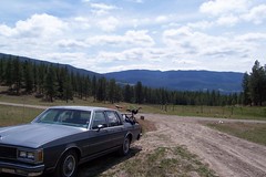
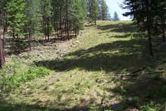
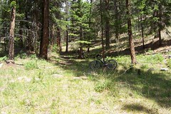
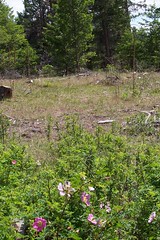
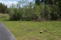
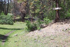
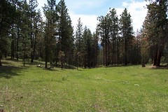
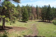
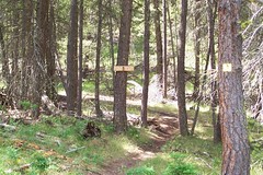
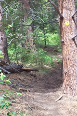
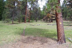
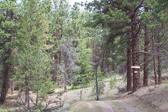
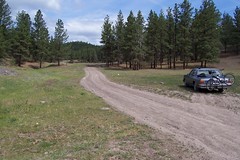
A cross country riders paradise. The most developed system in town. A ton of loop option from 30 mins to epic, rolling hills to lung buster climbs.

My thumb had healed enough by Saturday to try it. The Merritt site describes how to get there from town. The next set of posts and pictures will show what it looks like.
Richard

Near CocoBonk in Merritt


merritt1
Originally uploaded by Boonerator.
The photo referred to in the previous post.

Merritt trails

I was in Merritt from June 1 to June 4 for a conference and brought my bike.
I have an old Brodie hardtail with an adjustable fork. Old school for sure but it suits the trails I like.

The first place to look if you are going to Merritt is the Merritt Mountainbike club. They have some great info and point you to the map of the area available locally at the Mandolins Coffee shop.

The map is really worth it, very well done.

First afternoon, Wednesday after a lot of driving around I found my way to Coco-Bonk. The start of it is the picture on their home page. Lots of cattle around and deep ruts.
I am unused to ruts and failed to lift my front wheel when trying to get out of one. Small crash, small scrape but a hyperextended thumb. I carried on but when you cannot shift up on the rear cassette, you are a little limited in what you can ride.

The country up there is beautiful, see this picture from very close to Coco bonk.

Purpose of the Blog

I try to find different trails in BC to ride, cross-country is my preference, really technical stuff poses the question of how fast my bones will heal.

Considering I seem to keep falling, scenic, easy to intermediate trails are for me.

What better way to find trails than to look on the Internet and see some illustrated trip reports.

The posts in this blog are my contribution to collective trail knowledge in British Columbia.


Richard